
Thousand Islands and Eastern Ontario
Where the Canadian Shield meets the St. Lawrence.
The St. Lawrence River widens as it leaves Lake Ontario, spreading around granite outcrops that rise just above the waterline. These are the Thousand Islands – 1,864 of them by official count, though only a fraction have names. The archipelago stretches 80 kilometres from Kingston to Brockville, straddling the Canada–United States border along a waterway that has carried explorers, soldiers, and summer visitors for centuries.
This part of Eastern Ontario sits on the Frontenac Arch, a spine of Precambrian rock connecting the Canadian Shield to the Adirondack Mountains. UNESCO recognized the area as a World Biosphere Reserve in 2002, noting the unusual intersection of northern and southern ecosystems. Shagbark hickory grows alongside white pine. More than 80 fish species inhabit the river’s varied depths.
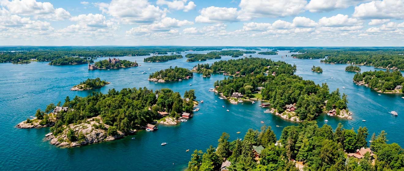
The Thousand Islands Region
The islands range from bare rocks supporting a single tree to Wolfe Island, the largest, which has farms, a village, and a ferry connection to Kingston. To qualify as one of the Thousand Islands, a land mass must stay above water year-round and support at least one living tree.
Thousand Islands National Park, managed by Parks Canada, encompasses 21 islands along the Ontario shore. It is the smallest national park in Canada by land area, just nine square kilometres, but offers camping, hiking trails, and docking facilities accessible only by private boat or water taxi. The St. Lawrence itself does not warm enough for comfortable swimming until July, though shallow bays heat up earlier.
The Thousand Islands Parkway runs 37 kilometres along the shoreline from Gananoque toward Brockville. A parallel cycling and walking path follows the same route, offering views of the river and access to beaches and picnic areas managed by the St. Lawrence Parks Commission.
Gananoque sits at the western end of the parkway, calling itself the Gateway to the Thousand Islands. The name is Indigenous in origin – “water rising over rocks” or “garden of the Great Spirit,” depending on the source. Boat tours depart from its waterfront, as do helicopter flights for those who want the aerial view.
Along the Rideau Corridor
The Rideau Canal connects Kingston to Ottawa across 202 kilometres of lakes, rivers, and hand-cut channels. Between these endpoints lies Rideau Lakes Township – 500 kilometres of shoreline spread across the largest municipality in Leeds and Grenville County. The township encompasses villages like Newboro, Portland, and Chaffey’s Lock, each clustered around historic lockstations.
Jones Falls, roughly halfway between Kingston and Smiths Falls, features the stone arch dam that remains one of the engineering marvels of the canal system. Foley Mountain Conservation Area, overlooking Westport, offers the highest point on the 300-kilometre Rideau Trail – a footpath connecting Kingston to Ottawa that passes through the township.
The Cataraqui Trail, a rail trail on a former CN right-of-way, runs through Portland, Elgin, and Chaffey’s Lock, connecting to the broader Eastern Ontario trail network. Cyclists can now complete the 360-kilometre Eastern Ontario Rail Trail Loop linking Renfrew, Frontenac, and Lanark counties with Rideau Lakes and Smiths Falls.
Rideau Ferry, between Upper and Lower Rideau Lakes, marks the approximate midpoint of the waterway. Boats heading from Kingston to Ottawa pass through here, and the village has served canal traffic since the 1830s.
St. Lawrence River Communities
Kingston anchors the western end of the region, where Lake Ontario meets the St. Lawrence. The city served briefly as Canada’s capital in the 1840s and retains the limestone architecture of that era. Fort Henry, built to defend the canal entrance, now operates as a national historic site with costumed interpreters and ceremonial military displays.
Brockville lies 80 kilometres downstream. Canada’s first railway tunnel, built in 1860, runs beneath its downtown – restored now as an illuminated pedestrian passage. The city’s waterfront includes the Aquatarium, an interpretive centre focused on the ecology and history of the St. Lawrence.
Between them, smaller communities dot the shoreline: Rockport, Ivy Lea, Mallorytown. East of Brockville, the river continues past Prescott, Morrisburg, and Cornwall toward the Quebec border. Upper Canada Village near Morrisburg recreates an 1860s Ontario settlement with over 40 heritage buildings, costumed staff, and working farms.
The St. Lawrence Parks Commission manages much of this corridor – 12 riverside parks, six beaches, campgrounds along the Long Sault Parkway, and the historic sites at Fort Henry and Upper Canada Village. Together these facilities draw over 1.7 million visitors annually.
Outdoor Activities
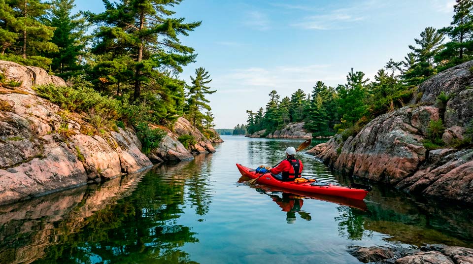
Paddling dominates the summer months. Sea kayaks navigate the sheltered passages between islands; canoes explore the Rideau Canal’s quieter reaches. The St. Lawrence current requires attention, but protected bays offer calmer water for beginners.
Cycling follows established routes: the Thousand Islands Parkway trail, the Cataraqui Trail north toward the Rideau, and the Great Lakes Waterfront Trail that traces the entire shoreline from Kingston to the Quebec border. The terrain stays mostly flat, though the Shield rock adds occasional rolling sections.
Fishing draws anglers for muskellunge, northern pike, largemouth and smallmouth bass, and walleye. The river’s varied depths create distinct habitats; local guides know which species gather where. Ontario fishing licenses are required.
Scuba diving has developed around the shipwrecks that rest on the river bottom – casualties of the commercial shipping era before the St. Lawrence Seaway opened in 1959. Visibility varies with season and weather.
Getting There and Around
Highway 401 runs through the region, with exits at Kingston, Gananoque, Brockville, and points east. The drive from Toronto takes approximately three hours; from Montreal, about two.
VIA Rail serves Kingston and Brockville on the Toronto–Montreal corridor. Kingston’s station sits near the downtown waterfront.
Ferries connect the mainland to larger islands. Wolfe Island, Howe Island, and Simcoe Island are all reachable by ferry from Kingston or nearby landings.
The Thousand Islands Bridge crosses to the United States at Hill Island, linking Highway 401 to Interstate 81 in New York State. Travellers crossing require valid passports or NEXUS cards.
Travellers arriving by air typically land in Ottawa or Toronto. Ottawa’s airport sits closer – about 80 kilometres from Smiths Falls, 170 from Kingston. Either way, a car makes exploring the region considerably easier than relying on scheduled transit.
📌 Official Resources
- 1000 Islands Tourism – 1000islandstourism.com Visitor information for Gananoque, Brockville, and the islands.
- Parks Canada – Rideau Canal – parks.canada.ca/rideau Lock schedules, navigation information, camping reservations.
- St. Lawrence Parks Commission – parks.on.ca Fort Henry, Upper Canada Village, parkway information, campground bookings.