
Conservation Areas in Ontario
The public lands most people drive past without noticing.
Ontario has over 300 publicly accessible conservation areas spread across the province. They sit alongside highways, behind suburban neighbourhoods, at the ends of gravel roads. Most visitors head straight to provincial parks (Algonquin, Killarney, Sandbanks) and skip these smaller protected lands entirely. That is a mistake worth correcting.
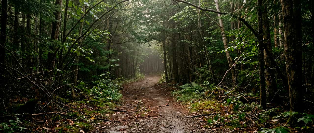
Conservation areas are not provincial parks. They are managed by local conservation authorities, funded partly by municipalities, and focused on watershed protection rather than tourism. Many have no entrance gates, no visitor centres, no gift shops. What they do have: trails through forests that have been protected since your grandparents were young, rivers that run clean because someone has been watching them for decades, and parking lots that stay half-empty even on summer weekends.
The Conservation Authority System
Conservation authorities date back to 1946. The province created them after decades of poor land and water practices had left much of southern Ontario eroded, deforested, and prone to flooding. The idea was simple: manage natural resources on a watershed basis, because water does not respect municipal boundaries.
“The Conservation Authorities Act, 1946 was legislated in response to concerns expressed by agricultural, naturalist and sports groups who highlighted that much of the renewable natural resources of the province were in an unhealthy state.”
— Conservation Ontario
Hurricane Hazel Changed Everything
Then came Hurricane Hazel. On October 15, 1954, the storm dropped 285 millimetres of rain on the Toronto region in 48 hours. Rivers overflowed. Bridges washed out. Eighty-one people died in the Greater Toronto Area alone. Damages exceeded one billion dollars in today’s currency.
The disaster changed everything. The provincial government amended the Conservation Authorities Act, giving these agencies power to acquire floodplain lands and regulate development near waterways. The Toronto and Region Conservation Authority formed in 1957, replacing four smaller bodies. Conservation authorities became the agencies responsible for keeping people from building houses in places where houses would flood.
That remains their core mandate. But along the way, they also became Ontario’s second-largest landowner after the province itself, managing approximately 146,000 hectares of forests, wetlands, and conservation areas across southern and northern Ontario.
The System in 2026
Until recently, 36 independent conservation authorities operated across the province. Each had its own board, budget, and priorities. Some managed dozens of conservation areas with extensive trail networks. Others focused primarily on flood control and permit reviews.
In March 2026, the provincial government announced plans to consolidate these 36 authorities into nine regional bodies. The stated goal: consistent standards, reduced administration, and faster permit approvals for development projects. The new regional authorities will cover larger watersheds – Western Lake Erie, Eastern Lake Ontario, Lake Huron, and so on.
The province has emphasized that conservation areas will continue to operate. Trails will remain open. Programs will continue. But the local boards that have governed these lands for decades will be replaced by larger regional structures. Whether this improves or diminishes the system remains to be seen. For now, the conservation areas themselves are unchanged.
What You Can Do There
Conservation areas offer most of the same activities as provincial parks, often with fewer crowds and lower fees. The numbers across the system:
- More than 8,400 campsites
- Over 2,600 kilometres of trails
- 37 interpretive centres for education programs
- Approximately 6 million visitors annually
Activities vary by location. Most conservation areas allow hiking and cross-country skiing. Many permit fishing, canoeing, and mountain biking. Some have beaches. A few offer camping, though campgrounds are less common than at provincial parks. For more camping options across Ontario, including drive-ins and backcountry sites, see our outdoor guide.
The experience differs from provincial parks in ways that matter. Conservation area trails tend to be shorter – loops of two to ten kilometres rather than multi-day routes. Facilities are simpler. You are less likely to find flush toilets and more likely to find pit privies. But you are also less likely to compete for parking at 7 a.m. on a long weekend.
Five Conservation Areas Worth a Visit
Hundreds of conservation areas exist across Ontario. A few stand out for specific reasons.
Foley Mountain – Spy Rock and the Rideau Trail
Foley Mountain Conservation Area sits on a granite ridge overlooking Upper Rideau Lake near the village of Westport. The 325-hectare property includes 10 kilometres of trails and the famous Spy Rock lookout – a cliff face created when a meteor struck the region and triggered an earthquake that sheared away the mountainside.
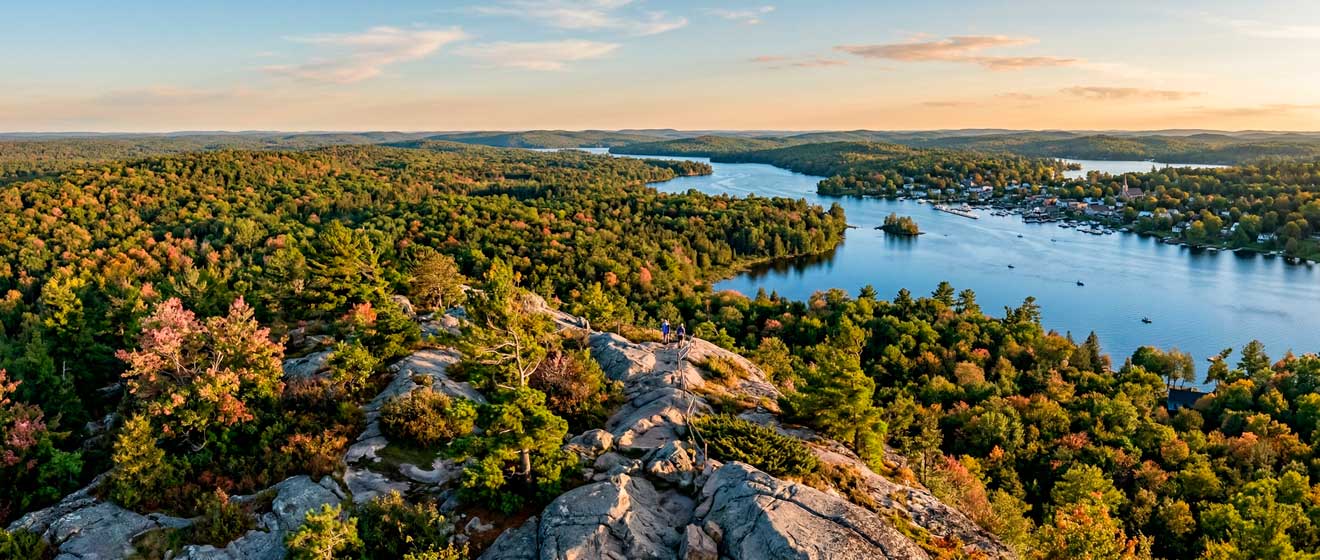
The view from the top covers the lake, the village, and the surrounding forest. The Rideau Trail, a 300-kilometre route connecting Kingston and Ottawa, passes through the property. The trail is part of the broader Thousand Islands and Eastern Ontario region worth exploring. There is a small beach on the lake.
Purdon – Canada’s Largest Orchid Colony
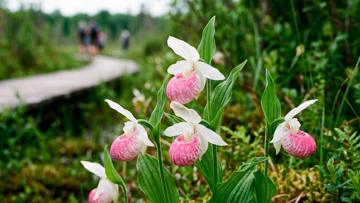
Purdon Conservation Area in Lanark County holds Canada’s largest native colony of Showy Lady’s Slipper orchids, approximately 16,000 plants. A farmer named Joe Purdon discovered a small cluster of the orchids in the 1930s and spent the next fifty years cultivating the colony.
The Mississippi Valley Conservation Authority acquired the site in 1984. A 400-metre boardwalk now winds through the fen wetland where the orchids grow. The bloom period runs from mid-June to early July, typically peaking around Father’s Day. Outside bloom season, the site remains open for hiking through the upland forest.
Morris Island: Accessible Trails Near Ottawa
Morris Island Conservation Area occupies 47 hectares along the Ottawa River near Fitzroy Harbour, about 40 minutes west of downtown Ottawa. The property includes a distinctive feature: the Causeway, a flat 1.8-kilometre trail built on a former railway bed that was relocated in the 1920s to accommodate construction of the Chats Falls Generating Station. The trail offers accessible walking with panoramic views of islands and calm water. Six kilometres of trails wind through forests and wetlands. The site is jointly owned by Ontario Power Generation and the City of Ottawa, managed by the Mississippi Valley Conservation Authority.
Vanderwater and the Limestone Steps
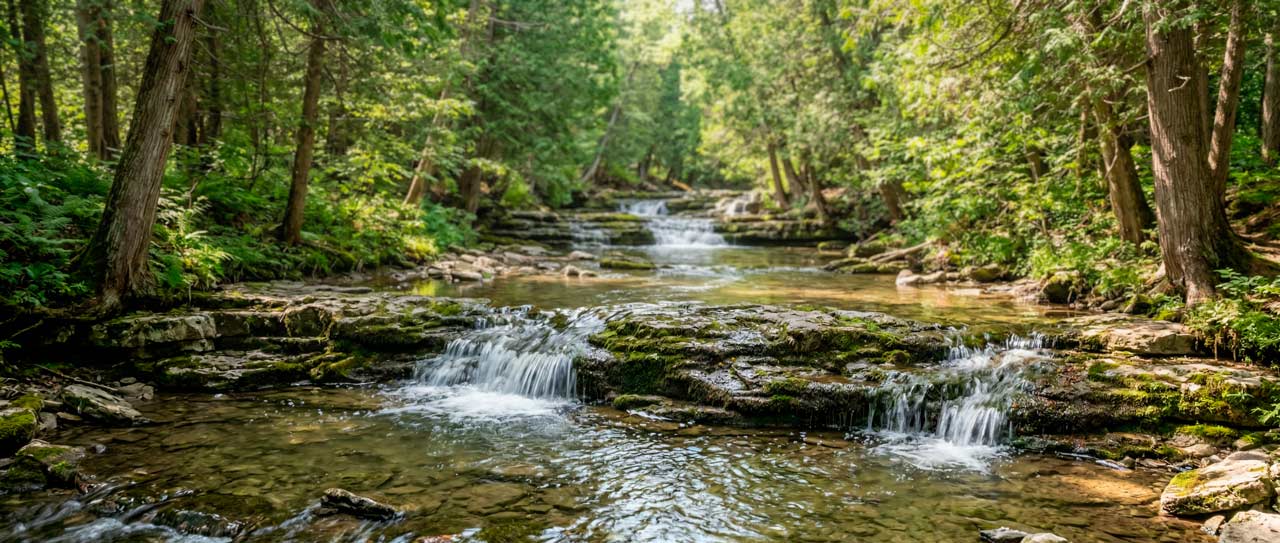
Vanderwater Conservation Area in Hastings County covers 257 hectares along the Moira River east of Thomasburg. The river here cascades over a series of limestone steps – a feature that draws visitors in summer when the water runs warm enough for wading. Sixteen kilometres of trails pass through mature cedar forests and along the river valley. The property includes a scout camp and several cabins available for group rentals.
Greenwood in Durham Region
Greenwood Conservation Area straddles Ajax and Pickering in Durham Region, following the banks of Duffins Creek. The property includes six trails of varying difficulty, a portion of the Trans Canada Trail, and an off-leash dog area. The creek holds rainbow trout fishing season opens in spring. The conservation area was established in 1958 when 300 acres were marked as a wildlife sanctuary. It has remained relatively unknown despite sitting within commuting distance of millions of people.
East of Toronto, Enniskillen Conservation Area protects 65 hectares on the south slopes of the Oak Ridges Moraine in Durham Region. The site has 5.5 kilometres of trails through cedar swamp and mixed forest, with boardwalks crossing wetlands and two ponds along Bowmanville Creek. The Moorey Grist Mill operated here from 1874 until 1956 – the earthen dam that created the millpond is still visible. Brook and brown trout remain in the creek. Central Lake Ontario Conservation manages the site; a $6 parking fee applies (credit card only).
Further east, Depot Lakes Conservation Area sprawls across 1,214 hectares of Canadian Shield north of Verona, in the Land O’ Lakes region. Second, Third, and Fourth Depot Lakes make up the system, connected by portages and known for some of the best bass and pike fishing in Eastern Ontario. This is Quinte Conservation’s only property offering camping – 20 interior sites accessible by canoe, scattered along shorelines and on small islands. The 9 kilometres of hiking trails are rugged; proper footwear is essential. Wildlife sightings include moose, black bear, and porcupine.
Plan Your Visit
Fees and hours vary by conservation authority and by property. Some conservation areas charge parking fees of five to ten dollars per vehicle. Others are free. Some close seasonally. Many stay open year-round but do not maintain trails in winter – bring snowshoes if visiting after a snowfall.
The best approach: check the website of the relevant conservation authority before visiting. Conservation Ontario maintains a central directory at ontarioconservationareas.ca with links to individual properties. Each conservation authority – Rideau Valley, Mississippi Valley, Quinte, Toronto Region, and others – publishes its own maps and fee schedules.
A few practical notes. Conservation area trails are often less well-marked than provincial park trails. Download a map to your phone before you leave cell coverage. Facilities are basic, pack out what you pack in. And if a trail seems empty on a Saturday afternoon in October, that is normal. These are not destinations that draw tour buses.
What Conservation Areas Protect
Conservation authorities exist primarily to prevent floods and protect water quality. The trails and campsites and beaches are secondary – services provided because the land happens to be publicly owned and people want to use it.
But the secondary purpose has value. These properties protect habitat for species that cannot survive in subdivisions. They filter rainwater before it reaches wells and rivers. They provide green space in regions where green space is disappearing under asphalt. And they offer something increasingly rare: outdoor recreation without reservations, without crowds, without the feeling that nature has been packaged for consumption.
The 330 provincial parks get the attention. The conservation areas do the quiet work.
📌 Official Resources
- Conservation Ontario – conservationontario.ca
- Ontario Conservation Areas Directory – ontarioconservationareas.ca
- Rideau Valley Conservation Authority – rvca.ca
- Mississippi Valley Conservation Authority – mvc.on.ca
- Quinte Conservation – quinteconservation.ca
- Toronto and Region Conservation Authority – trca.ca